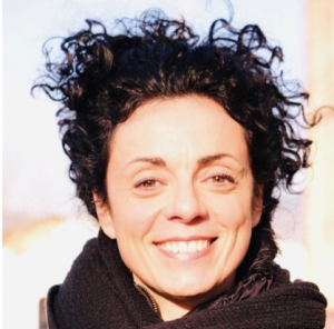
Sara Gentilini

Bio
My name is Sara, I am 43, I am Italian, I love sport and nature.
I am living half of my time in Norway, where I have contributed for 12 years to develop the amazing Magma UNESCO Global Geopark, and where I have established my Company and my family.
I am an historian and archaeologist with passion for cultural and natural heritage, sustainability, and local food.
I have been working in the field of UNESCO Global Geoparks since 2009, developing more than 20 international projects in the field of education, culture, technologies, heritage interpretation and education.
I have become UNESCO Global Geoparks evaluator in 2019.
I am the inventor and funder of the GEOfood international movement for the
development of local communities in the frame of the UNSDGs. www.geofood.no
Doctoral Research Topic: Earth Science-The role of Ecosystem Services in the assessment of abiotic nature within two UNESCO Global Geoparks.
Methodology: The research framework is divided into three main phases:
1. The research baseline: desk research, literature review- field surveying, selection of time and spatial scales.
2. The analysis and selection of two geosite ́s classification methodology in Italy and in Norway and the development of a new classification method.
3. The abiotic ecosystem services compared with the existing biotic ecosystem assessment: the selection of variables and the development of indicators and innovative assessment methodology for abiotic ecosystem services, within selected space and time.
Outcomes:
The research started from the desk analysis of the UNESCO Global Geoparks, which included the geosites’ geological and cultural background, their classification adopted at the time of application to the UGGps, and the geosite methodology, which can be identified with the “Stakeholders consultation and object and targets identification” in the “Biodiversity Indicators Development Framework” described above.
The proposed methodology includes the selection of the “case study” geosites, field inspections regarding those selected geosites, and results in data; said results have been compared with the preliminary analysis of the abiotic ecosystem services and the related classification of 25 abiotic ecosystem services outlined by Gray. (Table 9- Green circles)
Through the collection of Data, Questions and Indicators, the field and desk research were combined and the preliminary classification of the representative geosites was gathered in a “database for geosite recording”, considered to be a common framework for geosite classification between Italy and Norway; this record is the first product of this research (Blue Circle NI, Table 9).
The research on existing biotic ecosystem classifications and applications and its subsequent comparison within the already proven methodologies related with abiotic ecosystem services assessment results in the analysis of the overall qualitative characters of the selected geosites. (Blue Circle NII, Table 9).
The provisional analysis of the abiotic ecosystem (Blue Circle 2), the key questions and Indicator use and the application of existing scientifical biotic service approaches to the abiotic features of the Geopark selected led to the detection of a conceptual model based on provisional abiotic indicators.
The provisional model has been tested and refined with stakeholders (Yellow Circle 4A).
The gathering of data, the final provisional assessment, led to the development of the monitoring-reporting system, which constitutes the third product of this research (Blue Circle NIII).
The results obtained through this research could give a concrete benefit to the two Geoparks which were investigated. As the abiotic assessment shows, within the analysis of the four geosites selected (Annex 6), the abiotic ecosystem services play a relevant role in the interpretation, consequent geosite development, and overall land planning on behalf of Geopark managers and policy makers.
The research final assessment method allows managers and policy makers, with the support of a multidisciplinary team, to preliminarily assess the territory in an innovative way considering climate issues, land use, geohazards, soil presence, water and food provisions, education and culture, all in one.
The application of the abiotic service assessment could positively influence all the activities related with a UNESCO Global Geopark, from planning to delivering educational courses, visibility and interpretation panels, infrastructure and cooperating with local communities, and strengthening the bottom-up approach, which is crucial for successful Geopark territories.
In fact, thanks to a deeper analysis of the abiotic natural services, it would be easier to establish strong relationships with landowners, food producers, craft makers, and local stakeholders who are the custodians of intangible heritage and often feel mistreated by local planners.
The preliminary definition of indicators for abiotic nature aims at incentivising a stronger cooperation between “bio” scientists and “geo” scientists, who are both equally important for understanding the nature around us.
Tech4Culture Fellow – Call 1 (2018)
Supervisor: Marco Giardino, Department of Earth Sciences
